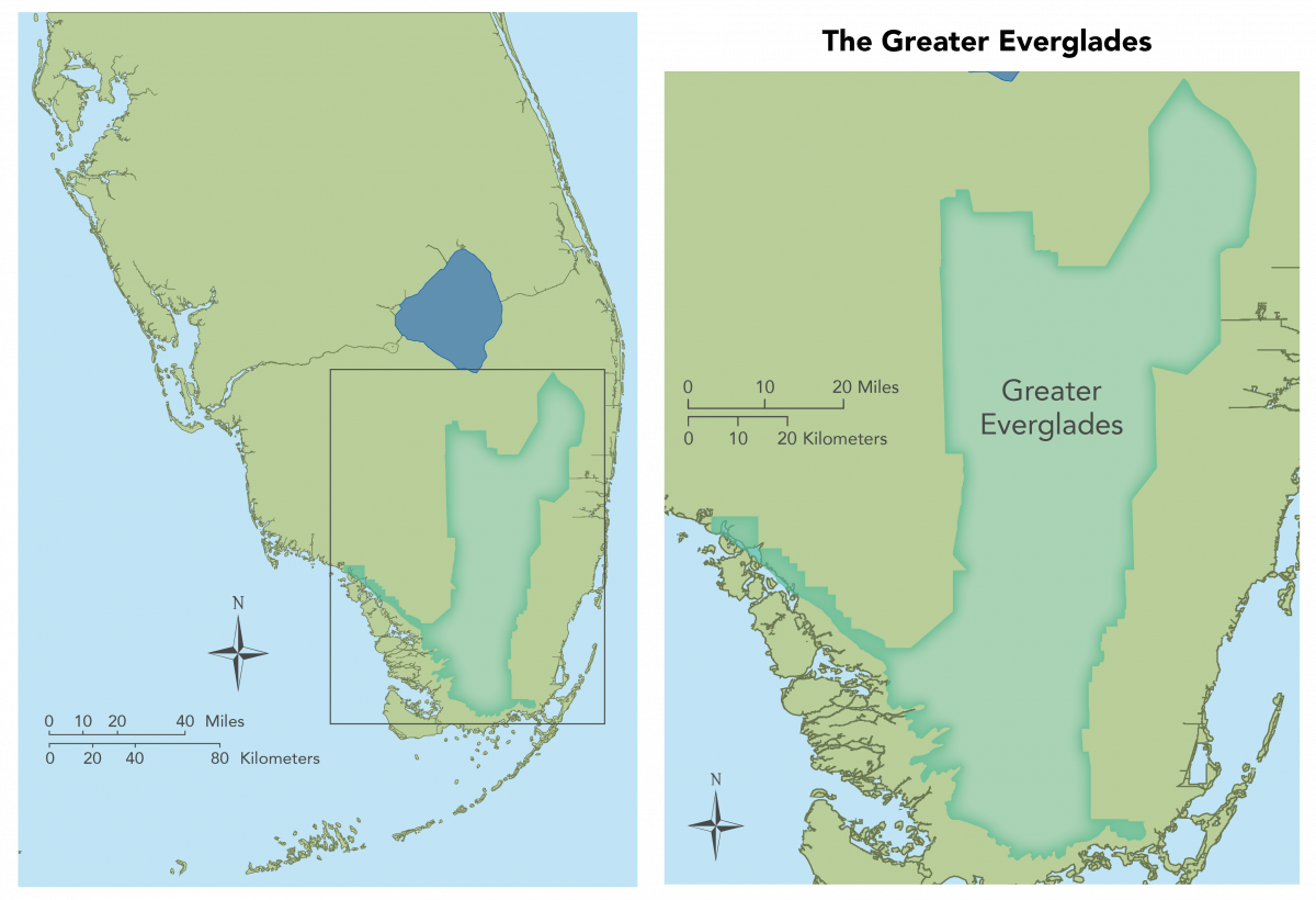
Greater Everglades
The Greater Everglades ecosystem is a dynamic system that experiences annual water level fluctuations as a result of wet and dry season rainfall patterns over the course of the year. It includes a mosaic of inter-connected freshwater wetlands differentiated by elevation, soils, hydrology, and vegetation. A ridge and slough system of patterned, freshwater peatlands extends throughout the Water Conservation Areas and into Shark River Slough. This drains into tidal rivers that flow through mangrove estuaries and into the Gulf of Mexico. Higher-elevation marshes, characterized by marl substrates and exposed limestone bedrock, flank either side of Shark River Slough. Marl marshes east of this area form the drainage basin for Taylor Slough, which flows through an estuary of dwarf mangrove forests and empties into northeastern Florida Bay. To the west of Water Conservation Area 3 and Everglades National Park, the Everglades marshes merge with the forested wetlands of Big Cypress National Preserve. In the past, the Greater Everglades were characterized by a unique combination of sheet flow, water depth patterns, oligotrophy, salinity distributions (in coastal estuaries), landscape patterns, and an abundance of wildlife, particularly large numbers of breeding wading birds. Today, the geographic extent of this region has been reduced by roughly 50%, the spatial and temporal patterns of hydrology, fire, and nutrient supply have been altered, landscape-scale structure of the ridge-slough mosaic has been lost, and wildlife populations have declined.